All industries
Government & Public Safety
One shared picture. Every agency. Every hazard.
For emergency management, police, and fire, Signal4D provides a common operating picture for all-hazards awareness and multi-agency coordination — integrating weather, wildfire, airspace, infrastructure, personnel and drones into a single view.
Request a demo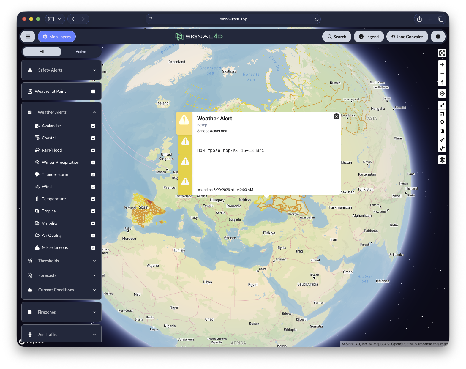
What you get
Built for how government & public safety teams work.
- Maintain a shared operating picture across agencies and jurisdictions
- Coordinate multi-agency preparedness, response and recovery
- Track personnel, vehicles and response assets in real time
- Integrate drone operations for first response and live verification
- All-hazards: storms, wildfire, extreme heat and public-safety events
Common questions
Weather intelligence for government & public safety, answered.
- What is a common operating picture for emergency management?
- A common operating picture (COP) for emergency management is a single, shared, real-time view of an unfolding situation — weather, wildfire, infrastructure, personnel, and response assets — that every agency and jurisdiction sees at once. Signal4D delivers this COP on one interactive map with role-based access, so emergency managers, police, and fire coordinate from the same picture instead of separate feeds.
- How do agencies coordinate across jurisdictions during severe weather?
- With Signal4D, agencies across jurisdictions work from one shared operating picture that combines government watches and warnings, live radar and lightning, wildfire detection, and the locations of personnel, vehicles, and response assets — supporting multi-agency preparedness, response, and recovery for all-hazards events.
- Can public safety teams track drones and field personnel in Signal4D?
- Yes. Signal4D ingests live telemetry for personnel, vehicles, and drones, and integrates drone operations for first response and live verification — so an incident commander can see responders, aircraft, and the hazard on the same map in real time.
More answers on the Signal4D FAQ and in the weather-intelligence glossary.
See it on your own operation.
See how Signal4D applies to your government & public safety operation — your assets, your territory, your thresholds.