All industries
Aviation & Airspace
Keep aircraft, crews, and cargo moving — safely.
Signal4D gives aviation and airspace teams one picture of weather, airspace, and traffic — across airports, ground operations, and drone flights — so disruption and risk are seen early and managed ahead of time.
Request a demo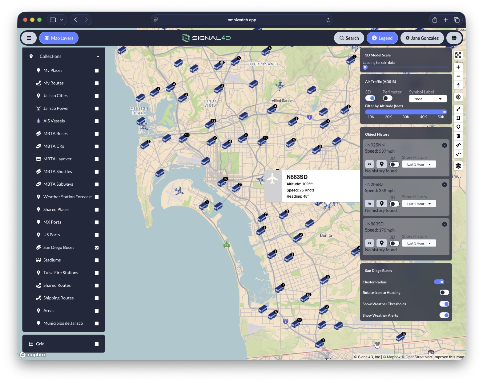
What you get
Built for how aviation & airspace teams work.
- Airport and ground-weather safety to reduce disruption and protect crews and cargo
- Drone / UAS flight monitoring and alerting with airspace awareness
- Severe-weather monitoring across airports and operations
- One operating picture: weather + airspace + moving assets, command center to field
Common questions
Weather intelligence for aviation & airspace, answered.
- How do airport and ground operations teams use weather intelligence?
- Airport and ground-operations teams use weather intelligence to see disruption coming — lightning within stop-work radius, convective wind, low ceilings, winter weather — and act before it reaches the ramp. Signal4D monitors severe weather across every airport an operator serves and alerts on the thresholds each station sets, protecting crews, cargo, and turnaround times.
- Can Signal4D monitor drone (UAS) flights?
- Yes. Signal4D provides drone and UAS flight monitoring with airspace awareness — live drone telemetry on the same map as weather, hazards, and other traffic, with alerting when conditions along the flight path exceed safe thresholds.
- Does Signal4D show live air traffic?
- Yes. Signal4D integrates live ADS-B air-traffic tracking — position, altitude, speed, and heading — into the operating picture alongside weather and airspace hazards.
More answers on the Signal4D FAQ and in the weather-intelligence glossary.
See it on your own operation.
See how Signal4D applies to your aviation & airspace operation — your assets, your territory, your thresholds.