Skip to content
Signal4D · Global Intelligence

Global intelligence for your assets and operations.

Signal4D fuses the world’s leading weather and environmental information with your infrastructure, assets, and personnel — including your moving assets such as fleets, vehicles, vessels, and aircraft — to monitor conditions and then predict and alert on the conditions that threaten your operations and missions.

OmniWatch global operating picture with weather, hazard and asset layers
The problem

All the data exists. What’s missing is one picture of what it means for you.

Seeing a lightning strike the moment it happens. Being alerted when satellites detect hot spots. Knowing when critical weather thresholds are crossed — or will be. Understanding the risk to your infrastructure. Knowing where your people and equipment are, right now.

What’s missing is the ability for decision-makers, managers, field crews, and mission planners to see all of it on a single screen — customized to what you actually operate, backed by best-of-breed analytics and real-time alerting.

Three pillars for proactive awareness

Global situational awareness, through a single pane of glass.

Signal4D brings together three principal pillars to create a unified solution.

01

Aggregated Environmental Data

Weather, radar, lightning, storm tracks, satellite hot spots and fire data — current conditions and forecast, from best-of-breed global sources.

02

Assets, Infrastructure & Operations

Your plants, lines, pipelines, routes, land and operations — plus the moving assets you track in real time: fleets, vehicles, vessels, aircraft, drones and personnel. Modeled as points, lines and polygons, and updated with live telemetry.

03

Enterprise-wide Access

A single pane of glass for the operations center, desktop and field — delivered via an intuitive interactive map, dashboard, email alerting and mobile, and built to extend through open APIs into the systems you already run.

The platform

From raw data to the decisions you need to make.

Five capabilities, working as one continuous loop — ingest, model, assess, alert, act.

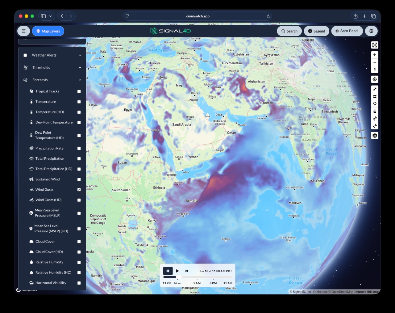
Environmental Data Fusion

All relevant data, current and forecast.

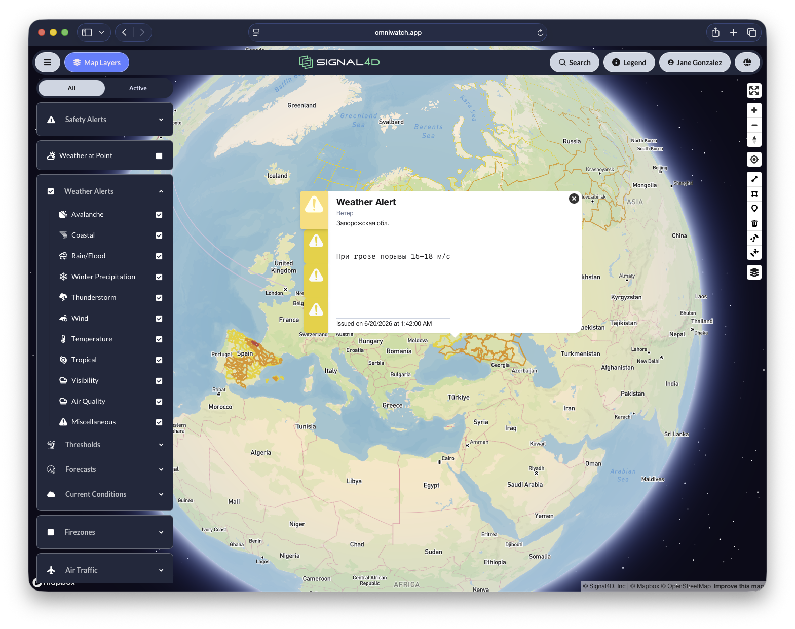
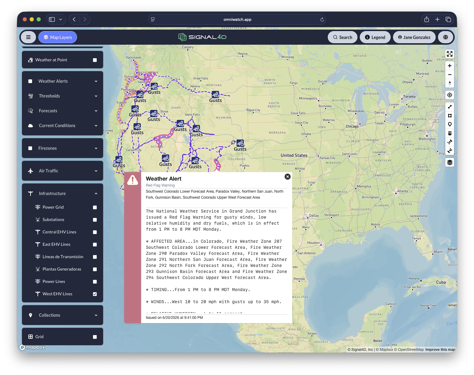
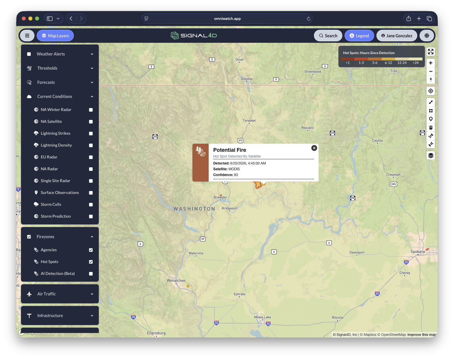
We ingest and harmonize best-of-breed global environmental data — current conditions and forecast — so you have access to the most relevant and integrated data available.

  • Weather models, local stations and surface observations
  • Radar — continental, regional and single-site super-resolution
  • Global lightning strikes and density
  • Storm tracks, cells and severe-storm prediction
  • Satellite hot spots, fire and agency fire data
  • Government weather alerts, hail, flood and air quality

Asset & Infrastructure Modeling

Your world, as points, lines and polygons.

Open APIs ingest your static and moving assets so the map reflects what you actually operate — not just the weather.

  • Moving assets updated live by telemetry — fleets, vehicles, vessels, aircraft, drones and personnel
  • Static assets: plants, substations, power lines, pipelines
  • Networks: supply lines, trucking routes, distribution centers, ports
  • Land: forested holdings, parcels and service territories
  • Store and replay full history paths

Impact Intelligence

Not just where — what it means for you.

We overlay the environment onto your assets to compute current and forecast impact, down to the specific segment, asset, location and timing.

  • Which power-line segment, which vehicle, which facility
  • Specific locations with timing — now and ahead
  • Risk profiles for infrastructure and assets
  • Historical and predictive analytics and modeling

Compound, Multi-Source Alerting

The signal, not the noise — in time to act.

Alert only when the conditions that matter actually align. Because Signal4D fuses many sources into one picture, it can combine them into a single, high-confidence alert.

  • Multi-condition logic (e.g. high temperature AND high wind on a line)
  • Compound events (red-flag warning + lightning + satellite hot-spot near an asset)
  • Custom thresholds per asset, route or territory
  • Dynamic monitoring zones — drawn by users or generated automatically as conditions evolve
  • Delivered via interactive map, dashboard, email, SMS and mobile

Common Operating Picture

One single pane of glass, enterprise-wide — and extensible.

A shared, role-based view from the operations center to the field — configurable, secure, and built to embed.

  • Deployed enterprise-wide: ops center, desktop and field
  • Role-based access and tenant management
  • Integrate GIS, asset-lifecycle and fleet-telemetry systems
  • Consolidate enterprise IoT: weather stations, cameras, drone sensors
  • Developer portal and APIs for programmatic integration and embedding

Built to fit how your organization works.

Explore the platform
The product

Intuitive, integrated application interface.

OmniWatch is the application behind Signal4D — an interactive map, dashboards and alerts your whole organization can use.

Live weather alerts on the interactive mapInfrastructure monitoring and threshold alertingRemote sensing of hot spots and fire activity
Preparing for extreme wildfire risk
Featured case study

Proactive resilience for wildfire and critical infrastructure

Wildfire is a weather-driven risk. Signal4D detects red-flag conditions, lightning strikes and satellite hot spots — then pinpoints the exact power-line segment, moving asset and location at risk, with timing.

Read the case study
Why Signal4D

The power of geospatial, at the speed of Signal4D.

Speed

Rapid deployment and integration — measured in hours and days, not months.

Flexibility

Highly configurable thresholds, layers and views, tailored to how your teams actually work.

Scalability

Enterprise-grade and global — from a single site to continent-wide operations.

Compound alerting

Multiple risk signals combined into one actionable alert, so teams get the signal and not the noise.

Your assets, in motion

Real-time telemetry for fleets, vehicles, vessels, aircraft, drones and personnel, fused with the environment around them.

Extensible platform

Open APIs, developer portal, and integrations that fit how your organization already works.

Southeastern US utilities tracking tropical-storm threats across hundreds of users.
Western US utilities monitoring fire risk, lightning and satellite hot spots.
A global logistics operator reducing weather impact at airports worldwide.
A South American industrial-gas distributor with a continent-wide view of perils.

See risk earlier. Understand impact faster. Act with confidence.

See how Signal4D gives your team a single, proactive view of every risk to your operation.