Skip to content
Case Studies

Proof, across very different operations.

The same platform, configured to each customer’s assets and territory.

Power grid with a red-flag warning in OmniWatch

Wildfire & critical infrastructure

Challenge. Wildfire is a weather-driven risk that threatens power lines, crews, and the communities around them — and it moves faster than fragmented tools can keep up with.

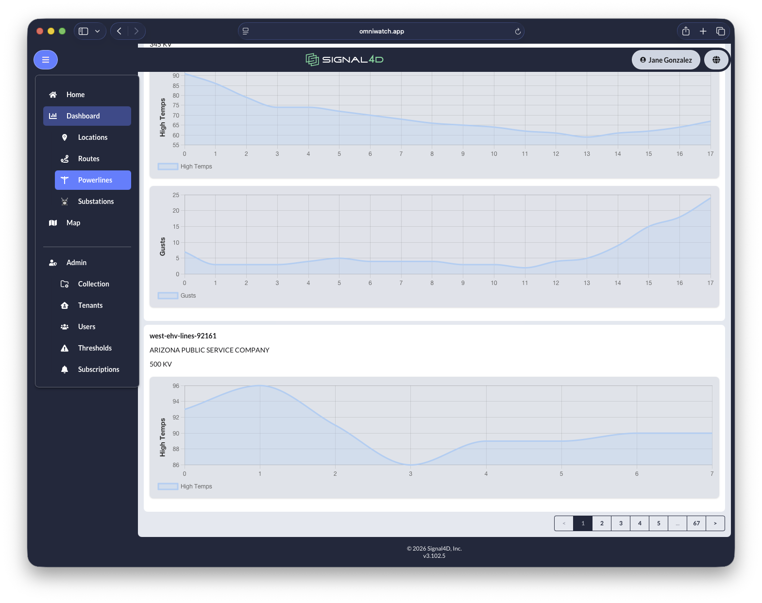
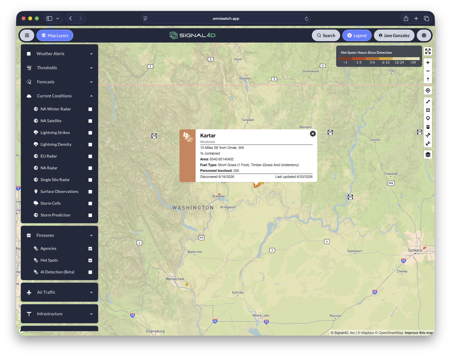
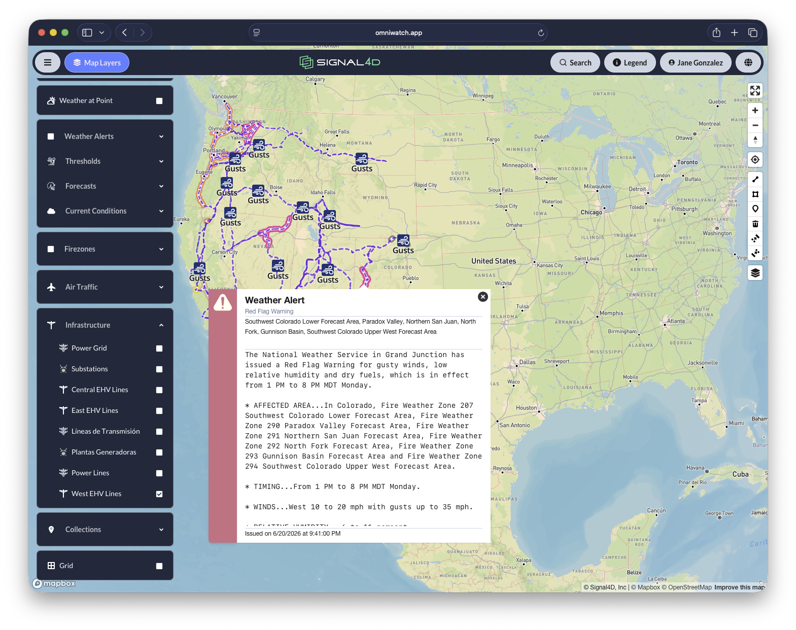
What Signal4D did. Fused red-flag weather, lightning, and satellite hot-spot data with the customer’s infrastructure, then pinpointed the exact segments and assets at risk, with timing, and alerted the right teams.

Outcome. Earlier detection of ignition risk near critical assets, sharper prioritization of crews and inspections, and a shared picture across operations and the field during high-risk conditions.

Read the full story
Per-powerline forecast dashboards across a utility service territory

Storm-ready grid — a major Southeastern utility

Challenge. Tropical-storm season puts the grid, crews, and large service territories at risk, with hundreds of people needing the same situational picture at once.

What Signal4D did. Brought tropical-storm tracks, wind, lightning, and asset data into one operating picture used across hundreds of users, with compound alerting tuned to the network.

Outcome. Faster pre-positioning of crews, a coordination hub across the territory during major events, and real-time awareness of personnel and response assets.

Weather alerts across a network of monitored locations

Keeping cargo moving — a global air-delivery company

Challenge. Weather across a worldwide network of airports and ground operations drives costly disruption and risk to crews and cargo.

What Signal4D did. Delivered airport and ground-weather awareness in one picture, tied to the operation’s own facilities and assets, with alerting on the conditions that matter.

Outcome. Earlier visibility into weather impact across the network, supporting proactive decisions that reduce disruption.

Weather alerts along a multi-stop logistics route

One view, end to end — a global supply-chain operator

Challenge. Disruption can hit anywhere across routes, facilities, and ports, with no single view tying weather to operational impact.

What Signal4D did. Unified weather and hazard data with the operator’s routes, facilities, and ports, and tied it to assets in motion.

Outcome. One picture of weather impact across the network, supporting rerouting, continuity planning, and proactive communication.

Active wildfire incident detail on remote land holdings

Protecting the land — a major landowner

Challenge. Large, remote holdings are hard to monitor, and a small ignition can become a major fire before anyone sees it.

What Signal4D did. Monitored dry conditions, lightning, and satellite fire activity across the holdings, using historical analysis to cut false positives.

Outcome. Earlier identification of likely ignition events and faster response decisions to protect timber, land, and crews.

See risk earlier. Understand impact faster. Act with confidence.

See how Signal4D gives your team a single, proactive view of every risk to your operation.